Dr. He Yin
|
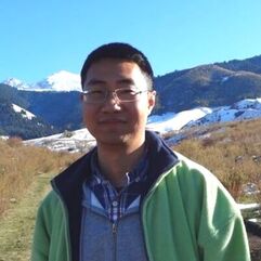
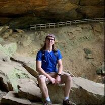
Dr. Yin is an Assistant Professor of Geography at Kent State University. Prior to joining KSU in 2020, He was a postdoctoral researcher at University of Wisconsin-Madison and a senior researcher at the Center for Development Research (ZEF), University of Bonn in Germany. He obtained my PhD degree in Geography at the Humboldt University of Berlin.
He develops remote sensing approaches and solutions to monitor land use and land cover change, enabling understanding of how such changes affect our environment and society via land system analysis. He is the principal investigator on projects funded by NASA, Lawrence Livermore National Laboratory, Center for International Forestry Research (CIFOR). His recent projects include investigating the impacts of armed conflict on land use, cropland abandonment, and grassland management using remote sensing, geospatial analysis, and modeling approaches. He currently serves as coordinator of the Global Land Programme (GLP) Working Group "Agricultural Land Abandonment as a Global Land-Use Change Phenomenon".
He develops remote sensing approaches and solutions to monitor land use and land cover change, enabling understanding of how such changes affect our environment and society via land system analysis. He is the principal investigator on projects funded by NASA, Lawrence Livermore National Laboratory, Center for International Forestry Research (CIFOR). His recent projects include investigating the impacts of armed conflict on land use, cropland abandonment, and grassland management using remote sensing, geospatial analysis, and modeling approaches. He currently serves as coordinator of the Global Land Programme (GLP) Working Group "Agricultural Land Abandonment as a Global Land-Use Change Phenomenon".
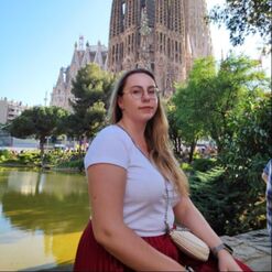
Corrine's research focuses on applying remote sensing and spatial analysis to landscapes of the past in order to better understand both natural and anthropogenic processes. Her dissertation work involves mining legacy data from the Landsat and Hexagon satellite programs to track the development of irrigation networks in Cambodia during the time of the Khmer Rouge. Previous studies explored the utility of geostatistical techniques to a Terminal Classic Maya site at the household scale.
|
Hobbies: obsessively gardening, knitting, practicing martial arts.
|
|
|
|
|
Hobbies: Travelling; Biking; Running; Photography
|
Syed is a Ph.D. student in the Department of Geography at Kent State University from Bangladesh. He is particularly interested in understanding land use change, their impacts, human and natural influences behind them using remote sensing approaches.
Prior coming to Kent State he was a member of GIS and Remote sensing Lab, BSMRAU. He obtained his MS degree in Agroforestry and Environment with a major focus in GIS and Remote Sensing from B.S.M.R. Agricultural University. |
|
Esmaeel is a PhD student at Kent state university. His growing research interest revolves around the use of remote sensing and geospatial analyses to study human-environment interaction. His current focus is on land use and land cover change dynamics in conflict context, particularly the effects of the war in Syria on crop lands changes in the region. He has a Msc in geospatial analyses from Universiti Kebangsaan Malaysia and a Bsc. in Civil/Geotechnical engineering from Tishreen University, Syria.
|
Hobbies: Hiking, Outdoor, Cooking, Writing and Coding.
|
|
Hobbies: Travelling, makeup and Skincare, Formula 1 racing.
|
Aleksandra is a PhD student at Kent State University. Her interests revolve around using remote sensing in environmental monitoring and human-environment relations, especially land cover changes and land abandonment in relation to agriculture and forestry. She finished her M.Sc.Eng in Geodesy and Cartography with specialization of photogrammetry, remote sensing and GIS from Warsaw University of Technology and Military University of Technology, Poland. Prior to coming to Kent State University, she was a Junior Specialist at the Applied Geomatics Center at the Institute of Geodesy and Cartography and master student researcher in TRACE project at Jagiellonian University funded by National Science Center in Poland.
|
|
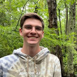
Jesse is a Master student focusing on the Syrian Civil War. He obtained his BSc. in Environmental Science from George Mason University in Fairfax, Virginia. Currently, he is working on utilizing remote sensing, spatial analysis techniques, and interviews to examine how farmers are impacted and adapting to ongoing conflicts. Prior to his arrival at the lab, Jesse has worked on examining land and forest cover changes using machine learning with the Smithsonian Conservation Biology Institute.
|
Hobbies: Hiking, Fencing, and Enjoying games with friends.
|
|
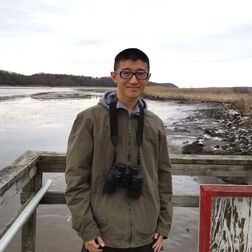
Hobbies: Hiking, Birding and Travelling
|
Andrew is an undergraduate environmental studies student at Kent State University. His current research project involves applying the remote sensing of agriculture to monitor cropland irrigation within the Lake Erie Basin. Outside of the lab, Andrew is co-editor-in-chief of the KSU Environmental Studies Newsletter and at Medina Raptor Center rehabilitating birds of prey. In the future he hopes to continue to share research and pursue further education in the application of remote sensing and land science.
|
Lab Alumni
|
|
